http://www.globalchange.umich.edu/globalchange1/current/lectures/kling/water_nitro/water_nitro.html
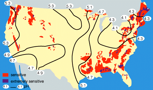
Isopleth maps generalize and simplify data with a continuous distribution. The data is shown via series of lines called isopleths, which connect points of equal value. These isopleths generally represent things like surface elevation, amounts of precipitation, atmospheric pressure, etc., because isopleth maps generally show data as 3-dimensional. Isopleths never cross or divide, and they always form enclosed circles.
This isopleth map shows the varying level of sensitivity to acid rain in the United States.
No comments:
Post a Comment