http://en.wikipedia.org/wiki/File:Wind_rose_plot.jpg
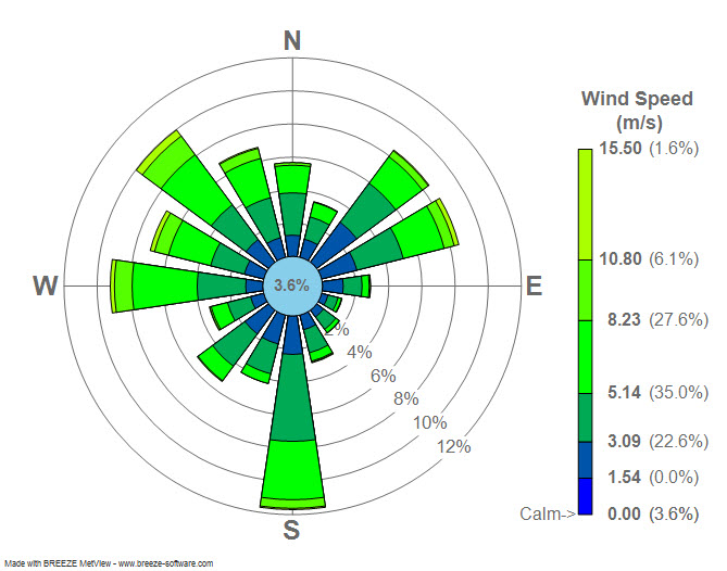
A windrose is a tool primarily used by meteorologists to see how wind-speed and direction are being distributed at a particular location. Meteorologists analyze the frequency of winds over a long period of time. They then use a polar coordinate system of gridding to plot it against wind direction; color bands depict different wind ranges. The directions of the rose (the combination of all of the "roses" is the windrose) with the longest spoke shows the wind direction with the greatest frequency.
The windrose map shown above shows the Windrose plot (Station #14732) at LaGuardia Airport, New York, New York.
No comments:
Post a Comment